
Facts About the Great Rift Valley: East African Rift Valley in Tanzania
The Great Rift Valley is one of Africa’s most spectacular natural landscapes, stretching across a vast region of eastern Africa and creating dramatic escarpments, volcanic mountains, deep lakes and fertile valleys.
In Tanzania, the East African Rift Valley is closely associated with some of the country’s most remarkable landscapes, including the Ngorongoro Highlands, Empakai Crater, Lake Natron and Ol Doinyo Lengai. These places reveal the extraordinary relationship between geology, volcanoes, wildlife, ecosystems and human history.
Although commonly called the Great Rift Valley, the geological feature is more accurately known as the East African Rift System (EARS). It is an active continental rift where the Earth’s crust is being stretched and gradually pulled apart.
What Is the Great Rift Valley?
The Great Rift Valley is a broad chain of geological depressions and valleys created by tectonic activity over millions of years.
The Earth’s crust is not a single unbroken shell. It consists of large tectonic plates that move slowly over geological time. In East Africa, the eastern part of the continent is gradually separating from the rest of Africa. The Somali Plate is moving away from the Nubian Plate, producing stretching, faulting, earthquakes, and volcanic activity.
As the crust stretches, large blocks of rock can move downward along faults, forming elongated valleys and basins. These geological processes have helped create the distinctive landscapes associated with the East African Rift Valley.
Rather than being one perfectly continuous valley, the Great Rift Valley is a complex system of connected rift basins, faults, highlands, and volcanic landscapes.
Where Is the East African Rift Valley?
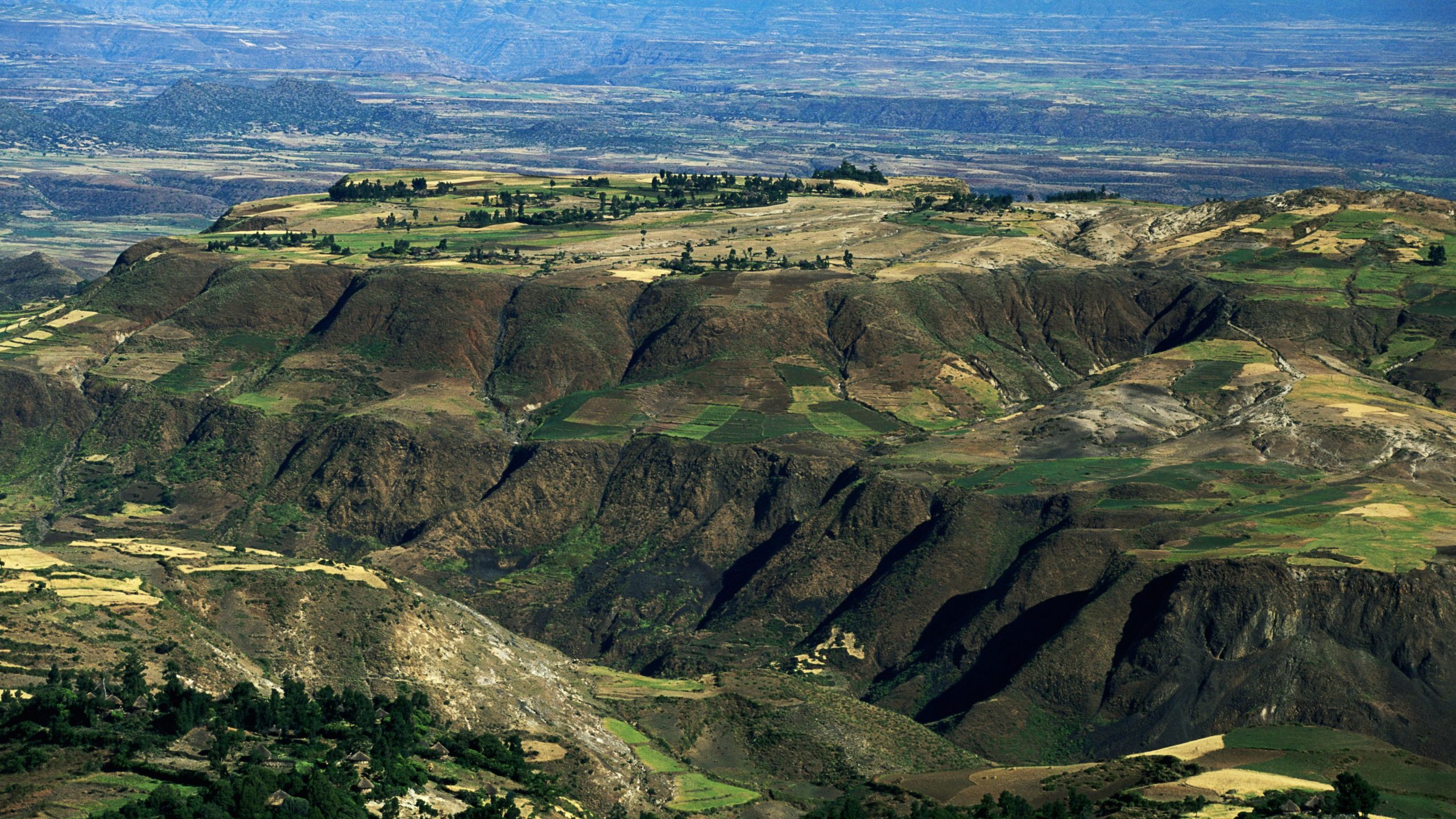
The East African Rift System extends for roughly 3,000 to 3,500 kilometres, from the Afar region of Ethiopia southward toward Mozambique. It includes two major branches: the eastern and western branches.
The eastern branch passes through Ethiopia and Kenya before continuing into northern Tanzania. The western branch curves through the Great Lakes region, including areas around Uganda, Rwanda, Burundi, the Democratic Republic of Congo, Tanzania, and Malawi.
The two branches are associated with different geological characteristics. The eastern branch is particularly notable for volcanic activity, while the western branch contains some of East Africa’s deepest rift lakes, including Lake Tanganyika.
The Great Rift Valley in Tanzania
Northern Tanzania is one of the most interesting places to experience the East African Rift Valley.
Here, tectonic forces and volcanic activity have produced an extraordinary landscape of highlands, craters, escarpments, volcanic cones and lakes.
Some of the best-known geological features include:
- Ngorongoro Crater
- Empakai Crater
- Olmoti Crater
- Ol Doinyo Lengai
- Lake Natron
- The surrounding Rift Valley escarpments and volcanic highlands
The landscape around northern Tanzania is a particularly good example of how geological processes can influence scenery, wildlife habitats and human settlement.
Ngorongoro and the East African Rift Valley

The Ngorongoro Conservation Area offers one of the most impressive places to experience the relationship between the Great Rift Valley and northern Tanzania’s volcanic landscape.
Ngorongoro itself is a vast volcanic caldera surrounded by highlands. Nearby volcanic features, including Empakai and Olmoti, add to the region’s remarkable geological diversity.
From the Ngorongoro highlands, the landscape descends toward the Rift Valley, with spectacular views extending toward Lake Natron and Ol Doinyo Lengai on clear days.
For visitors, this means that a trip to Ngorongoro is not only a wildlife experience. It is also an opportunity to see the effects of millions of years of volcanic and tectonic activity in the landscape.
Empakai Crater and the Rift Valley
Empakai Crater is another spectacular geological feature in the Ngorongoro highlands.
The crater is surrounded by forested slopes and offers remarkable views across northern Tanzania. Walking in this area provides a very different experience from a traditional safari because visitors can experience the landscape on foot and observe how vegetation, wildlife, and terrain change with elevation.
Depending on the route and current conservation regulations, walking experiences in the Ngorongoro highlands can connect visitors with the wider landscapes leading toward the Rift Valley.
Ol Doinyo Lengai: The Mountain of God
 One of the most distinctive landmarks of the Tanzanian Rift Valley is Ol Doinyo Lengai, whose name is commonly translated from Maasai as “Mountain of God.”
The volcano rises dramatically above the Lake Natron basin and is one of the defining geological features of northern Tanzania.
Ol Doinyo Lengai is particularly unusual because it is famous for its carbonatite lava, a rare type of volcanic lava rich in carbonate minerals. The volcano is located within the southern Eastern Branch of the East African Rift System.
The surrounding Lake Natron basin records a long history of volcanism, sedimentation, and faulting. Geological evidence from the area preserves a record extending back approximately two million years.
For adventurous travelers, climbing Ol Doinyo Lengai can be an unforgettable experience, although it is a demanding mountain and should be approached with proper preparation and local guidance.
Lake Natron and the Great Rift Valley
Lake Natron is one of the most unusual lakes in Tanzania and an important part of the Rift Valley landscape.
The lake occupies a basin within the East African Rift zone and is surrounded by volcanic mountains and dramatic escarpments. Its highly alkaline waters create an environment suited to specialized wildlife, including important populations of lesser flamingos.
The combination of Lake Natron, Ol Doinyo Lengai and the Rift Valley escarpments creates one of the most distinctive landscapes in northern Tanzania.
The southern Lake Natron basin is directly associated with the East African rift zone, and its geology records extensive volcanic activity and faulting.
Volcanoes of the East African Rift Valley
Volcanoes are one of the most visible signs that the East African Rift is an active geological system.
As the continental crust stretches and becomes thinner, magma can rise through fractures and weaknesses in the Earth’s crust. Over time, repeated volcanic activity can build mountains, cones, and extensive volcanic landscapes.
Northern Tanzania contains several important volcanoes and volcanic features associated with the southern part of the East African Rift. These include Ol Doinyo Lengai and the volcanic landscape around Ngorongoro.
Mount Kilimanjaro is also situated near the eastern flank of the southern end of the East African Rift Valley and is part of the broader volcanic landscape of northern Tanzania.
Lakes of the Great Rift Valley
The Great Rift Valley is famous for its lakes.
Some of East Africa’s major lakes occupy basins that have been strongly influenced by tectonic faulting and crustal stretching. The western branch of the rift contains several exceptionally deep lakes, including Lake Tanganyika.
In Tanzania and the surrounding region, Rift Valley lakes vary enormously in size, depth, chemistry, and ecology.
Lake Natron, for example, is very different from Lake Tanganyika. Their contrasting environments demonstrate how the geological structure of the Rift has produced a wide range of habitats across East Africa.
The Great Rift Valley and Human Evolution

The importance of the Great Rift Valley extends far beyond geology.
East Africa’s rift landscapes contain some of the world’s most significant archaeological and palaeontological sites. Northern Tanzania is especially important because of Olduvai Gorge, one of the world’s best-known locations for evidence of early human evolution.
The volcanic environment of the region played an important role in preserving archaeological and fossil evidence. Layers of volcanic ash and sediment provide valuable records of ancient environments and the animals and early humans that lived in them.
This makes northern Tanzania particularly important to scientists studying the long history of human evolution.
The Great Rift Valley and Wildlife
The geology of the Rift Valley has also helped create the diverse ecosystems for which East Africa is famous.
Volcanic mountains, highland forests, grasslands, lakes, wetlands and open plains occur across the Rift Valley landscape. These different environments provide habitats for a remarkable variety of wildlife.
In northern Tanzania, the relationship between geology and wildlife is particularly easy to appreciate around Ngorongoro.
The volcanic highlands influence drainage, soils, vegetation and water availability, while the surrounding plains provide important grazing areas for large herbivores and habitats for predators.
This is one reason why the geological story of the Great Rift Valley is also part of the story of Tanzania’s extraordinary wildlife.
Why Is the East African Rift Valley Important?
The East African Rift Valley is important for several reasons.
1. It is an active geological laboratory
The rift provides scientists with an opportunity to study continental rifting as it happens. The stretching of the Earth’s crust produces earthquakes, faulting, and volcanic activity.
2. It has created remarkable landscapes
The Rift has helped shape mountains, valleys, volcanic cones, escarpments and lake basins across East Africa.
3. It supports diverse ecosystems
The combination of elevation, volcanic soils, lakes, grasslands and forests creates a wide range of habitats for plants and animals.
4. It is important to human history
The Rift Valley contains some of the world’s most significant fossil and archaeological sites, particularly in Ethiopia, Kenya and Tanzania.
5. It is a major travel destination
The landscapes associated with the Great Rift Valley provide opportunities for wildlife safaris, hiking, cultural experiences, photography and geological exploration.
Is the East African Rift Valley Still Active?
Yes. The East African Rift is an active continental rift.
The crust is continuing to stretch, and different parts of the system experience earthquakes, fault movement and volcanic activity. The rate and nature of activity vary considerably from one section of the rift to another.
In northern Tanzania, the Natron Rift provides a particularly interesting example of ongoing interaction between tectonic processes and volcanism. Recent scientific research continues to investigate the relationship between magma movement, faulting, and deformation around Ol Doinyo Lengai.
East African Rift Valley vs. the Great Rift Valley
The terms East African Rift Valley and the Great Rift Valley are closely related, but they are not necessarily exact synonyms.
The Great Rift Valley is the familiar geographical name commonly used for the spectacular chain of rift landscapes across eastern Africa.
The East African Rift System is the more precise geological term describing the active continental rift system made up of multiple branches and rift segments.
For travelers visiting Tanzania, however, both terms are useful when describing the dramatic landscapes around Ngorongoro, Lake Natron, and the northern Tanzanian volcanic region.
Frequently Asked Questions About the Great Rift Valley
How long is the Great Rift Valley?
The broader East African Rift System extends for approximately 3,000 to 3,500 kilometres, from the Afar region toward Mozambique, depending on how its limits are defined.
Where does the East African Rift Valley begin and end?
The East African Rift System begins around the Afar region of Ethiopia and extends southward through East Africa toward western Mozambique. It consists of several interconnected rift segments rather than one simple valley.
Does the Great Rift Valley pass through Tanzania?
Yes. The eastern branch of the East African Rift extends into northern Tanzania, where it is associated with spectacular volcanic and tectonic landscapes including the Natron Rift and the Ngorongoro region.
What is the most famous feature of the Great Rift Valley in Tanzania?
There is no single answer, but Ngorongoro Crater, Lake Natron, and Ol Doinyo Lengai are among the most remarkable features associated with the Rift Valley landscapes of northern Tanzania.
Is Ngorongoro Crater part of the Great Rift Valley?
Ngorongoro is part of the broader volcanic and tectonic landscape associated with the East African Rift in northern Tanzania. The crater itself is a volcanic caldera rather than simply a rift valley.
Is Ol Doinyo Lengai an active volcano?
Yes. Ol Doinyo Lengai is an active volcano located in the Natron Rift of northern Tanzania. It is particularly famous for its unusual carbonatite lava.
Can visitors explore the Great Rift Valley in Tanzania?
Yes. The Rift Valley landscapes can be experienced through safari, hiking and cultural tourism in areas around Ngorongoro, Empakai, Lake Natron and other parts of northern Tanzania. Specific activities and access conditions depend on conservation rules, season, and local arrangements.
Experience the Great Rift Valley in Tanzania
The Great Rift Valley is far more than a long geological depression. It is a living landscape shaped by tectonic movement and volcanism, and it has influenced the lakes, mountains, ecosystems and human history of East Africa.
In northern Tanzania, the East African Rift Valley comes alive in the dramatic scenery of Ngorongoro, Empakai, Lake Natron and Ol Doinyo Lengai.
A journey through this region offers the opportunity to see the connection between geology, volcanoes, wildlife and human history in one of the most extraordinary landscapes on Earth.
Whether you visit for a Tanzania safari, a trek through the Ngorongoro highlands, a journey to Lake Natron or an adventure around Ol Doinyo Lengai, the Great Rift Valley provides a deeper story behind the landscapes that make northern Tanzania so remarkable.

